

For people that don't shop for their food online, finding their way around supermarkets isn't always the easiest of tasks. If they haven't been there before or staff have rearranged everything, they are forced to rely on signs hanging from the ceiling and spotting the particular product they want can take a while. To help fix that, Philips has developed a type of supermarket navigation system that utilises LED lighting and a companion smartphone app to help people find what they need.
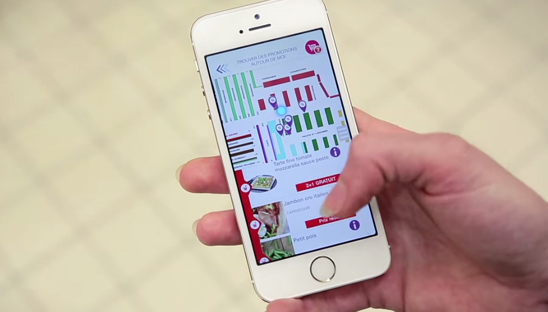
Using the system, shoppers can find their current location within the store and see the names of product types along different aisles, so searching for what they want becomes that bit easier and faster. However, to make that possible, the store needs to track someone's location, and GPS isn't easy to use in-doors and often isn't accurate enough to correctly determine someone's position down to more than a few metres. Instead, Philips system uses LED lighting that transmits a specific signature, which smartphones can use to pinpoint their location in relation to those particular lights.
This system is able to track a user's location at the sub-metre level, making it perfectly accurate for indoor usage. [yframe url='http://www.youtube.com/watch?v=uQw-o6bjrec']
Users can even set up a shopping list before hand and have the app direct them straight to the aisle they need for each item, making the shopping experience much more streamlined.
The system is being trialled at a Carrefour supermarket in France, but if it catches on could see more widespread adoption in other chains around the world. It seems likely that other stores, especially particularly large ones, could utilise the technology to help orient customers around their shop floors.
Discuss on our Facebook page, HERE.
KitGuru says: This seems like a pretty exciting technology, as indoor location tracking is something that has proved rather difficult for traditional solutions. It would be interesting to see it implemented in car parks to help find free spaces. Can you guys think of any other solutions for it?
Yeah, there’s a really obvious one, which is wifi triangulation. Use a mesh of wifi routers, and then the phone detects the signal intensity of each one, and triangulates its position by quarrying the fixed positions of each of the routers in the store. If you put a router or two above each aisele, I’m sure soon you could get sub metre accuracy.
Alternatively, use cameras, and OpenCV.
►►► $73.. per-hr @mi9//
,,,
➨➨➨https://WorldStarHipHopHosts.com/skills/help…